Southern Oregon Protected Land: Wilderness Rules, Real Risks, and How to Visit
Table of Contents
- Introduction: Protected Land in Southern Oregon Explained
- Settlement History in Southern Oregon
- Why So Much Land Is Protected in Southern Oregon
- The Biscuit Fire in Southern Oregon
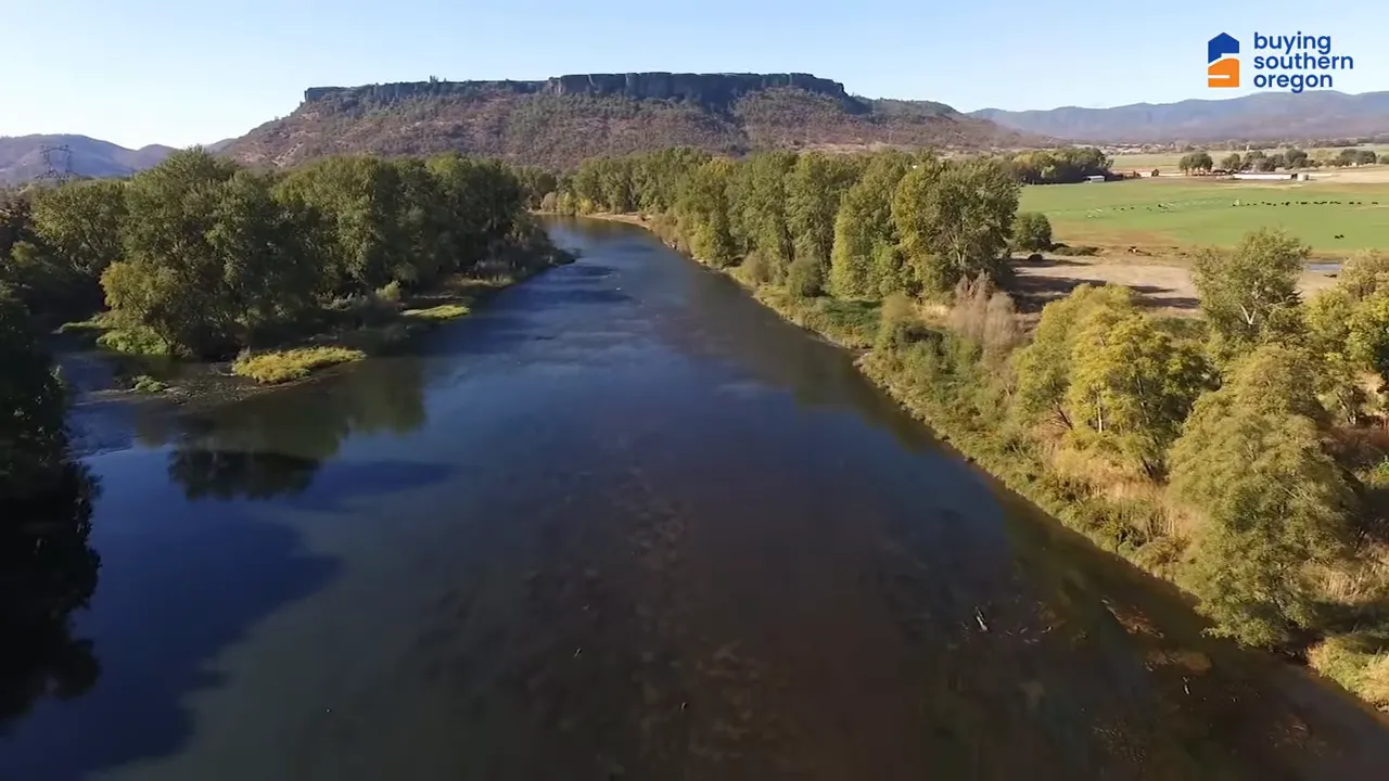
- Southern Oregon Geography
- Best Places to Visit in Southern Oregon’s Protected Lands
- Southern Oregon Safety and Real Stories
- How to Explore Southern Oregon Responsibly (Leave No Trace Tips)
- FAQs About the Protected Land in Southern Oregon
- Final Thoughts
Introduction: Protected Land in Southern Oregon Explained
Southern Oregon hides a vast, almost empty swath of land—and the reason is simple: protected land in Southern Oregon is intentionally kept free of development to preserve ecosystems, wildlife habitat, and rugged public wilderness. This post explains how that happened, what makes the area unique, the real risks of trying to settle there, and the best ways to enjoy this landscape responsibly.
Settlement History in Southern Oregon
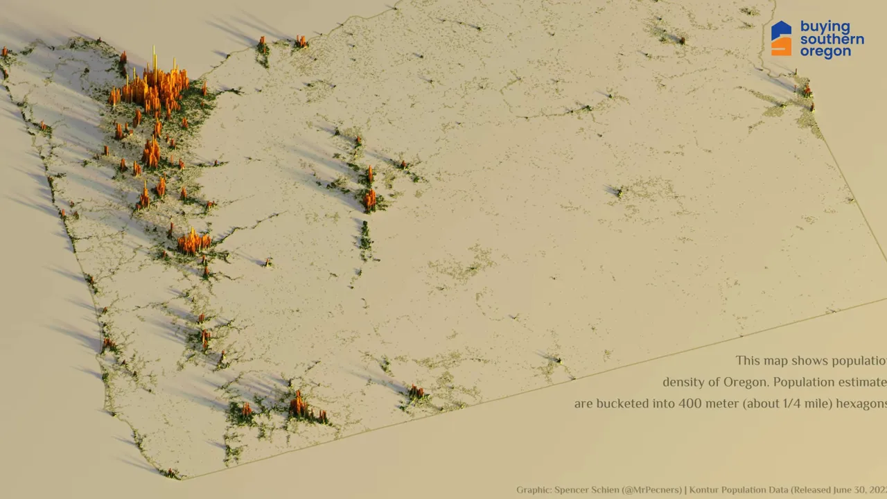
People first arrived in Southern Oregon in the mid 1800s chasing gold. Towns like Jacksonville and Ashland sprang up in the 1850s, and by the turn of the century places such as Grants Pass and Medford were established. Those towns remain the population centers today while the interior remained largely uninhabited.
The landscape never lent itself to easy farming or large settlements. Rugged terrain, dense forests, and steep river canyons made development expensive and dangerous, so much of the interior stayed wild.
Why So Much Land Is Protected in Southern Oregon
The main reason people cannot buy and build on large tracts here is conservation. This region contains extensive federally protected land including National Forest lands and designated wilderness areas. Those protections exist to preserve habitat, biodiversity, and wild rivers. In short, the government is protecting the land, not hiding a conspiracy.
You will find national forest, wilderness designations, and thousands of acres of public land that are managed to stay wild. That means no new residential subdivisions or standard utility development across vast areas.
The Biscuit Fire in Southern Oregon
Fire is one of the most significant natural threats. The Biscuit Fire of 2002 left a giant burn scar across hundreds of thousands of acres. This country is prone to intense, long-running wildfires because steep slopes and limited road access let fires spread and burn out of reach of suppression efforts.
For anyone thinking about homesteading in undeveloped mountain country, remember that access for emergency services and recovery after wildfire are major constraints.
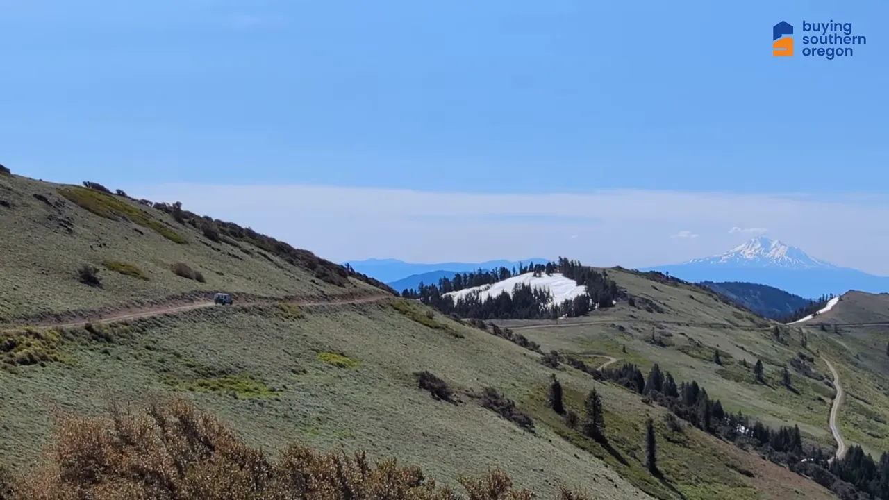
Southern Oregon Geography
Two mountain systems meet here: the Oregon Coast Range and the Siskiyou Mountains, a subrange of the Klamath Mountains. The Siskiyou run roughly one hundred miles from northwest California into southwest Oregon and include peaks over 7,000 feet. These ranges are known for extremely high biodiversity and extensive forests that support many species, including several that are endangered.
Heavy rain in these ranges feeds numerous rivers—the Illinois, Chetco, Pistol, Elk, Rogue, Sixes, and many tributaries and creeks. That wet mountain terrain creates fantastic habitat and world-class fishing opportunities, but also deep canyons and fast-flowing water.
Best Places to Visit in Southern Oregon’s Protected Lands
Despite being off limits for building, the area offers remarkable recreation:
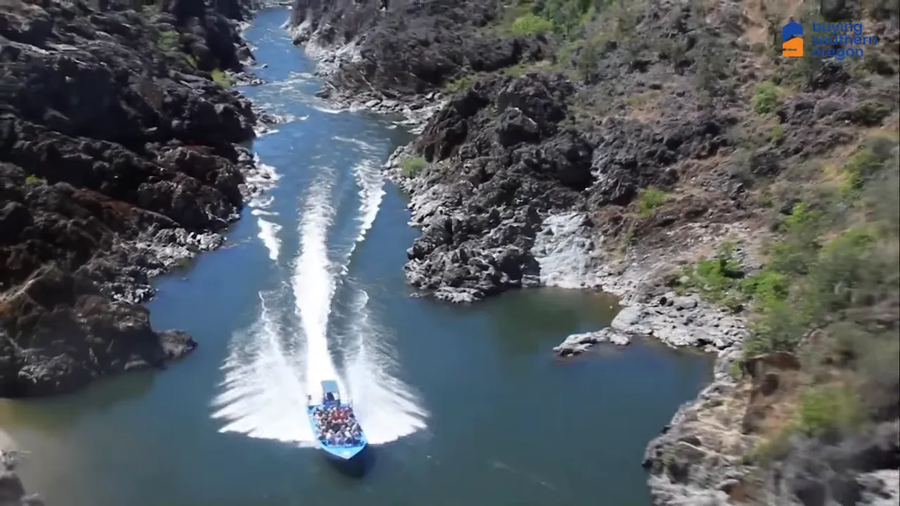
- Hellgate Canyon on the Rogue River—whitewater, jetboat excursions, and hiking on the Rogue River Trail.
- Illinois River swimming holes —including the Swinging Bridge and other deep, clear pools.
- Rogue River rafting —day trips from Hog Creek to Grave Creek and longer guided floats.
- Backpacking the Rogue River Trail —about a 40 mile stretch of true wilderness backpacking.
Southern Oregon Safety and Real Stories
The region is remote and unforgiving. In November 2006 a family from Seattle became stranded after taking a remote logging road called Bear Camp Road during a snowstorm. They were miles from help. After days of being stuck, the husband left to get help and never returned. That tragedy underscores how quickly things can go wrong and how difficult search and rescue can be in this terrain.
When you plan to explore protected land in Southern Oregon, respect the remoteness: check weather, leave trip plans, and use a reliable map. Cell reception is often nonexistent.
How to Explore Southern Oregon Responsibly (Leave No Trace Tips)
You may not be able to build a dream house in these protected landscapes, but you can experience them safely and respectfully. Here are practical ideas:
- Swim at the best holes on the Illinois River but always scout currents and never swim alone.
- Book a guided raft or jetboat trip on the Rogue River for safety and local knowledge.
- Hire a licensed guide for salmon and steelhead fishing if you want the best chance at a great catch.
- Backpack the Rogue River Trail with proper gear and wilderness permits if required.
- Learn low impact camping practices and follow leave no trace principles.
FAQs About the Protected Land in Southern Oregon
Why is so much land labeled as protected land in Southern Oregon?
Large areas are set aside as National Forest and wilderness to conserve biodiversity, protect watersheds, and preserve natural character. These protections prevent new residential development and infrastructure to keep ecosystems intact.
Can I buy property inside these protected areas?
No. Most of the protected land is public and cannot be purchased for private development. A few private inholdings exist, but building is limited or prohibited in many places.
Are there real dangers to visiting these places?
Yes. Fire, steep canyons, fast rivers, sudden weather, and poor road access create real hazards. Prepare thoroughly and consider guides for river trips and backcountry travel.
Where are the best spots to experience this landscape safely?
Popular, managed access points like Hellgate Canyon, the Rogue River launch points, and maintained trails along the Illinois River offer memorable experiences with lower risk when you follow safety recommendations.
How should I plan a visit?
Check forest service pages for trail and road conditions, book guided services when appropriate, pack for sudden weather changes, and tell someone your itinerary. Treat the area with respect and leave no trace.
Final Thoughts
Thanks for reading — this vast, protected swath of Southern Oregon may be off-limits to development, but it’s open to careful exploration. If you go, plan thoroughly, check Forest Service and trail/road updates, consider guides for river or backcountry trips, and always follow Leave No Trace practices. Base visits from nearby towns like Grants Pass, Medford, or Ashland for safer access and services. Respecting these protections helps conserve habitat and keeps this spectacular country wild for future generations.
Thinking of moving to Southern Oregon? If you’re ready to make the move (or just exploring your options), start with our free Relocation Guide: Download the Relocation Guide. For one-on-one help finding the right town, home, or neighborhood—taking into account wildfire risk, access, and proximity to outdoor recreation. Contact me anytime at contact 541-827-8767
Or browse current listings to get a feel for the market: Medford • Ashland • Grants Pass . If you want to move to Southern Oregon, I can guide you through the process and help you find the right place to call home.

Buying Southern Oregon
At Buying Southern Oregon, we are a dynamic team dedicated to helping you achieve your real estate goals. Combining Brian Simmons’ deep market expertise and Josh Berman’s strong negotiation skills, we provide personalized service and local knowledge to ensure a seamless and rewarding experience. Whether you’re buying, selling, or relocating, we’re here to guide you every step of the way and make your Southern Oregon real estate journey a success.
Watch Our Latest Video